
© 2010-2019 InterBering, LLC. All Rights Reserved.

by Xinhua, January 15, 2015

INTER. Sept. 23, 2012
by RIANOVOSTI, May 13, 2014
InterBering, LLC
BERING STRAIT TUNNEL & RAILROAD
CONSTRUCTION INVESTMENT CORPORATION
English
Connecting people and continents.
April 28, 2012
-----------------------------------------------
-----------------------------------------------
-----------------------------------------------
-----------------------------------------------
-----------------------------------------------
-----------------------------------------------
USA - Canada - Russia - China - Europe
International Railroad
 |
|---|
-----------------------------------------------
-----------------------------------------------
The Atlantic, July 1, 2015
-----------------------------------------------
-----------------------------------------------
-----------------------------------------------
InterBering, LLC Certificate of Membership
.
To get it, click here and apply.
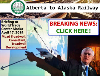
Alaska Governor Mike Dunleavy is asking President Donald Trump for permit needed to connect new 200 miles of Alaska Railroad to tar-sands oil fields in Canada, and Lower 48, supporting A2A, Alberta to Alaska Railway Development Corp.'s $17 Billion project by Sean McCoshen. By Alex DeMarban, ADN, April 1, 2019.
-----------------------------------------------
"BIG TICKET". Is Alberta to Alaska Railway Port Mac's Sugar Savior? The railway may become a reality in 2022 if Sean McCoshen of A2A Railway has his way. By Dennis Anderson, AP, Jan. 3, 2019.

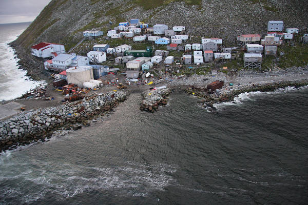
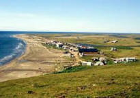
■ On the United States side the proposed Bering Tunnel would begin at Cape Prince of Wales in Alaska. The nearby city of Wales has a population of 156, paved roads and about 80 buildings including a large school, a general store and an airport. The other end of the undersea tunnel would emerge at the rural settlement of Uelen in Rusia's Chukotsky District.
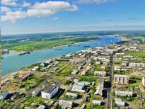
■ The railway line on the Russian side would continue on to the microdistrict of Ozyorny, located 8 miles (13 km) to the North of the Russian town of Egvekinot – which is a seaport on Kresta Bay. From there, skirting the nearby gulf, the railway would go to the cities of Bilibino, Zyranka, Ust-Nera and finally Yakutsk. There it would connect to the existing Baikal-Amur Mainline and the Trans-Siberian Railway systems. China and other Asian and European countries would all be accessible.
■ On the U.S. side the rail tunnel could be connected with Fairbanks, Alaska through the cities of Buckland, Huslia and Tanana – or through the slightly longer southern route via the city Galena on the north bank of the Yukon River, and then on to Tanana and Fairbanks.
■ It is also proposed that the tunnel pass under both Little and Big Diomede Islands which could be sited ventilation shafts and other facilities. Both Little Diomede (USA) and Big Diomede (Russia) have, in fact, been settled for centuries. Archeological findings date back over two thousand years. Little Diomede has a Inalik native village with a population of about 200 plus a high school, a store, a post office, a community hall and many residences.
The terrain of the Diomedes is similar to the fiords of Norway or the rolling grassy hills of Scotland. In wintertime, the surface of the Bering Strait itself is frozen.
■ Where the tunnels pass under America's Krusenstern Island (Small Diomede), a railway station could be built allowing passengers elevator access to the island. A world-class hotel would provide them with a mid-Strait vista of the confluence of the Pacific and Arctic Oceans. A stay at this iconic hotel, along with a journey on the magnetic levitation train serving it, would surely become a tourist attraction in its own right. A similar facility could be created on Russia's neighboring Ratmanov Island (Big Diomede).
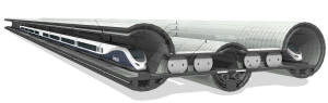
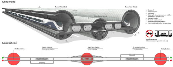
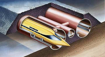
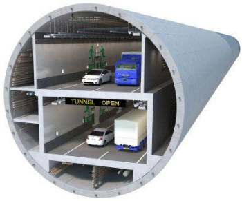
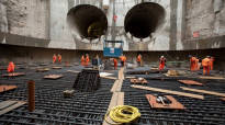
■ The tunnel project will actually involve construction of three parallel tunnels under the Bering Strait connecting the U.S. and Russia, along with sections of railway linking to the rail systems on each of the two continents.
■ Both of the two double-deck main tunnels (each 54 feet/16.5 meters outside diameter, 49 feet/15 meters inside diameter) will accommodate two-way traffic between Alaska and Russia. Both tunnels will also include two levels of traffic: the bottom part will have a heavier railway for high-speed cargo and passenger rail traffic; an upper level will include space for magnetic levitation trains, one or two lanes for automobiles, and additional space for a future Airless Maglev Tube Transport system (at speeds of up to 4,000 miles per hour). Still other space at the right and left "corners" of the bottom level will be used for water, gas and oil pipelines plus electrical and fiber optic cables.
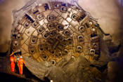
According to Dean Workman, vice president of the conveyor division at the Robbins Company, "large-diameter tunnels are actually easier to work with than small-diameter tunnels because you have much more room in the tunnel. In small-diameter tunnels everything is compacted and it is hard to find real estate for the conveyor in addition to the ventilation and utility lines. In the larger tunnels there is not only more room in the profile but also in the trailing gear".
(Tunnel Business Magazine, June 2017, page 18.)
■ A third tunnel (23 feet/7 meters outside diameter, 5.5 meters/18 feet inside diameter), built between the two main tunnels, will provide emergency access corridors to each main tunnel at regular intervals along the entire route. It will also house a road for use by emergency and maintenance vehicles.
■ The length of each tunnel will be about 74 miles/119 kilometers or more, which includes the width of the Bering Strait (64 miles/103 km) plus a distance not less than 5 miles/8 kilometers inland on each coast. This will result in better access for trains utilizing the tunnels.
■ Completion of the entire project will take 12-15 years, at an estimated cost of $35 billion.
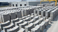
■ Excavation of the undersea tunnels will produce crushed basalt gravel (approximately 50 million cubic meters / 55 million cubic yards) which can be used in the construction of railway beds extending beyond each end of the tunnel. The quantity of this gravel product will be sufficient to lay a rail bed 20 inches (51 cm) deep at a width of 41 feet (12.5 meters), extending 4,873 miles (7,843 km) in length. This will cover the distance from the Bering Strait to Canada in America and much of the necessary access railway in Russia.
■ This gravel by-product also explains why construction of the interhemispheric North America - Eurasia railroad project should start with the tunnel portion. Moving the resulting crushed stone from the tunnel excavation site along future access rail beds will keep down the cost of their construction.
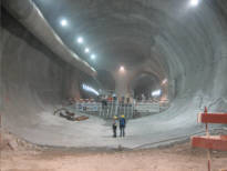
■ Construction will go on 24 hours per day. The tunnel workers will be laboring around 100 feet (30 meters) below sea level in an environment with a steady temperature of 25-30° Celsius (77-86° degrees Fahrenheit). The cooling system inside the tunnels will not therefore require air conditioning (a big savings!) because cool air can simply be vented in from the outside.
■ To house workers, engineers, equipment and materials huge underground depots will be constructed at the entrances to the tunnels. These will be designed to cover work areas from summer rain or winter snow (when outside temperatures may drop to -50° Celsius (-58° Fahrenheit). Warm tunnel air can be used to help keep depot temperatures moderate.
■ If equipped with high-speed trains run by magnetic levitation (with speeds of up to 300 miles per hour/480 km per hour) they will be the first use of such technology for profit. Tourists will be able to cross between the U.S. and Russia in just 15-20 minutes, with further links to Alaskan international airports in Fairbanks and Anchorage.
■ Extending the proposed underwater tunnel inland, beyond the 5-10 miles envisioned, may make economic sense. The combination of railways, highways and utility lines may actually be cheaper to build and maintain below ground than above ground in Arctic climes.
■ First of all, instead of building a series of roads and railways meandering along the slopes and foothills of mountain ranges, interspersed with mountain tunnels and bridges-a continuous tunnel could provide the shortest distance between points. The cost of constructing multiple surface tunnels might be more than that of a continuous underground tunnel. Things like the cost of preparation of the sites for each entry and exit to/from smaller tunnels, plus the relocation of boring machines and other construction equipment, quickly adds up.
■ Secondly, every structure on the surface would need to be maintained during long Arctic winters with frequent snowfalls. This would likewise eat into profits. Far less winter expense would apply to underground infrastructure. The profitability of the interhemispheric railroad between North America and Asia would depend on continuous and on-time circulation of trains carrying cargo and passengers. Heavy snows have the potential of disrupting traffic flow and impacting revenues.
■ The third, and probably the most costly expense in building roads and railways in the Arctic is the presence of permafrost – and the continuous freezing and unfreezing of the ground beneath thousands of miles of road or track. To avoid damage to rail and road beds, current practice involves widespread use of piles, and overpasses or bridges. Tunneling underground avoids all of this, while simultaneously providing space for utility lines and pipelines.
■ Underground transportation also carries the advantage that trains carrying passengers or cargo will require less inside insulation and heating. Cargo trains carrying containers with delicate electronic goods, plastics or liquids will be better protected from harsh outside conditions or damage to merchandise.
■ Yet another element in lowering the cost of construction by tunneling would be in avoiding environmental problems. Less ecological regulation comes into play in planning a tunnel route-while a surface railway project might be drowned for years in tons of paperwork to get regulatory approval. Each water stream, animal migration route or unique natural object would potentially be an expensive and time-consuming obstacle to construction, affecting the entire enterprise. A tunnel would not damage anything on the surface, and would involve the shortest possible route.
■ With all the above advantages in mind, the delivery of construction equipment and materials could be accomplished using the existing Alaska Railroad and the seaports in Anchorage and Valdez. The city of Fairbanks could become the starting point of a new era of global transportation, with the State of Alaska acknowledged for helping bring about a new world transportation infrastructure.
W
hether the proposed railroad tunnel is limited to the Bering Strait or extends along the route to Fairbanks, or whether it is built (as per InterBering) strictly with private funding or includes State and federal monies – it requires capital now to begin feasibility studies and to properly survey the proposed transportation corridor. Having all this completed will allow us to refine our cost estimates and to further clarify project options.
As all this could take up to 15 years to achieve, promotion work cannot begin soon enough!
If you are contemplating investment in this project, please contact us now at soloview@gci.net
The Alaska Railroad Corporation (ARC) should also apply for federal funding to extend the railroad to the west, through Alaska's interior and up to the Bering Strait – with the objective of continuing to Russia via the Strait. The ARC could thus open vast areas of the State containing mineral deposits, human resources and added tourist attractions.
The ARS experience in building and maintain railroads using State and federal funds, together with InterBering's links with private investors, Russian railroad construction companies and Russian government organizations – can together bring about a new and exciting phase of Alaska state development.
The Alaska Railroad Corporation could help begin this by building the stretch of railway from Fairbanks to the Bering Strait. The Bering Strait Tunnel itself could be planned and constructed by other subcontractors having direct experience in tunnel construction.
On the Russian coast, the Bering tunnel will be connected with the future railroad coming from Moscow and constructed by the JSC High-Speed Rail Lines, the associated company of Russian Railways, or its successors and assigns. Currently, JSC High-Speed Rail Lines is in charge of developing the first stage of the first Russian two-line high-speed 1007-mile (1620-km) railroad Moscow – Vladimir – Nizhny Novgorod – Cheboksary – Kazan – Ekaterinburg with travel time 8 hours and maximun speed up to 249 miles per hour (400 km per hour.)
.jpg)
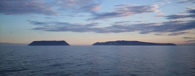
Little Diomede Island (USA, left) and Big Diomede Island (Russia, right) at Bering Strait.
Source: http://www.newworldencyclopedia.org/entry/Image:Diomede_Islands_Bering_Sea_Jul_2006.jpg
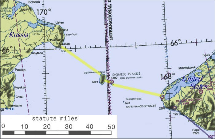
US NOAA nautical chart of Bering Strait.
Source: http://www.newworldencyclopedia.org/entry/Image:US_NOAA_nautical_chart_of_Bering_Strait.png
Bering Tunnel Route.
Source: http://upload.wikimedia.org/wikipedia/commons/9/95/BeringBridge.jpg
Little Diomede Island village of Diomede, Alaska, USA
Source: http://en.wikipedia.org/wiki/Little_Diomede
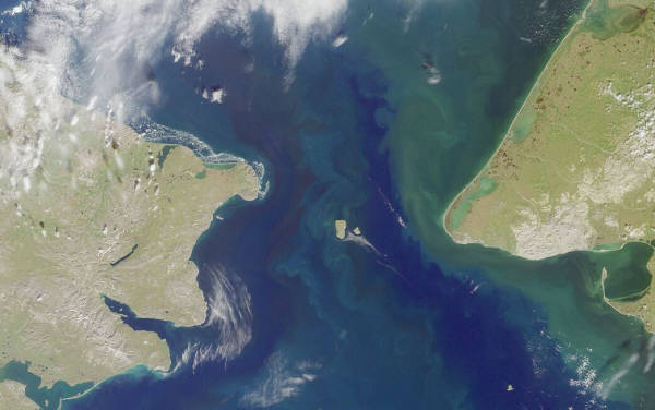
Bering Strait, separating Siberia from Alaska in the North Pacific.
NASA image, taken by MISR sattelite
Source: http://en.wikipedia.org/wiki/File:BeringSt-close-VE.jpg
Gotthard Base Tunnel in Swiss Alps - the longest railway 57-km (35.4 miles) dual tunnel in the world.
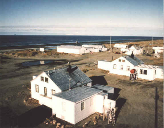
Cape Prince of Wales Field Station
Source: http://www.csp.navy.mil/asl/Alaska.htm
BERING STRAIT TUNNEL OBSERVATION
Design sample of one-deck and single-line traffic tunnel
Cross-section of tunnel under the Bering Strait
between Chukotka (Russia) and Alaska (USA). Enlarge.
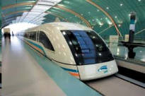
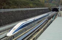
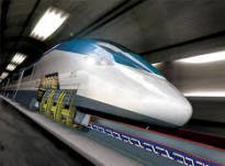
Magnetic levitation trains
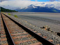
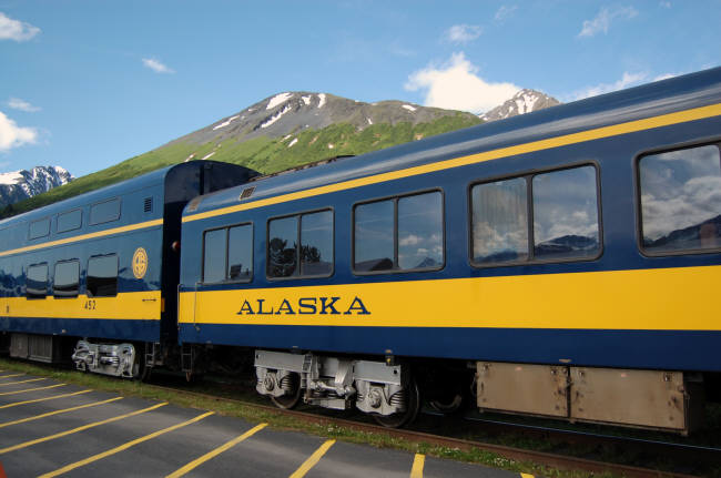
Railroad in Alaska on gravel rail bed near Girdwood
Photo: Fyodor Soloview
Different designs of underground tunnels.

Selo Uelen, Russia, Wiki.

City of Bilibino, Russia, Wiki.
Zyryanka, Russia, Wiki.
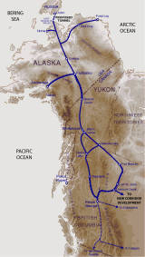
Proposed railroad from Yakutsk (Russia) through the tunnel under the Bering Strait to Alaskan cities Wales, Buckland, Huslia, Tanana, Fairbanks, Delta Junction and Tok, and further connection to Canada through White Horse and down to the South to contiguous United States. ENLARGE

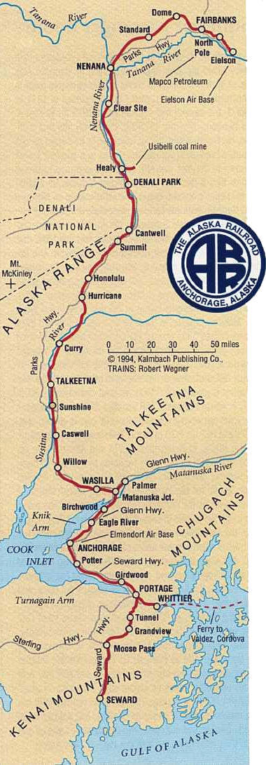
Map of Alaska Railroad. Alaska Railroad Website
Some interesting facts and data on the proposed construction of a Bering Strait Tunnel linking the railway systems of North America and Asia


Fairbanks. Alaska, USA, Wiki.
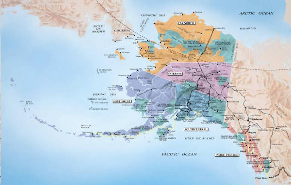
Map of Alaska.

Presentation of High-Speed Railroad Moscow- Kazan-Ekaterinburg (VSM-2)
(Slade-show in Russian)